The laneway south of Niagara that runs from Wellington to Tecumseth needs a new name (it’s currently called Lane W Niagara S Wellington).
This laneway will be the address for one of the residential buildings at our 2 Tecumseth Street project and continue to provide car access into the site and properties to the north of the lane.
Place naming is an intentional act of acknowledging the memory of people, places, events and ideas. It can include positive and honorific celebrations of the past and present, as well as acknowledgements of controversial and shameful dimensions of history and culture.
Public commemorations – like the naming of a laneway – are one way communities demonstrate what they believe is important to remember.
TAS is helping to facilitate this renaming initiative. Have a look at the Process and Timeline below for more details.
Indigenous & Natural History
- 2 Tecumseth Street is on the traditional territories of the Haudenosaunee, the Anishinaabeg, the Mississaugas of the Credit, and the Huron-Wendat peoples. It is covered by The Toronto Purchase (Treaty 13) which was signed in 1805 by the Mississaugas of the Credit.
- The landscape topography of this area echoes the Garrison Creek that once flowed through it. The creek’s beginnings stretch back around 12,000 years, when the Wisconsinan Glacier melted off the St. Clair West lands to form the original Lake Ontario shoreline and corresponding marshes.
- Garrison Creek was a stream that ran from its source near Vaughn Road, all the way south through Trinity Bellwoods and Stanley parks, along part of Niagara Street and had its mouth at Lake Ontario –just east of Fort York where the military garrison was stationed. It is said that at that time, the mouth of the creek was suitable for mooring a few small boats.
- During the 12,000 years of the creek’s existence, forests of pine, oak and locust covered the area. Indigenous peoples hunted here and travelled along this river corridor.
- Niagara Street was laid down as a flowing curve that lined the banks of the now buried Garrison Creek.
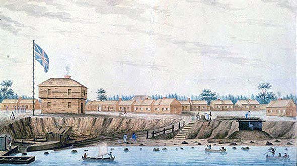
Fort York & the Shawnee Chief
- When the Fort York military garrison was established by John Graves Simcoe for the fledgling Town of York in 1793, the Niagara neighborhood began to take shape around it.
- In 1813, Fort York was attacked by a force of 2,700 American soldiers on 14 ships. In addition to the British soldiers stationed at the fort, a force of Anishinaabe warriors helped in the defensive effort.
- Many of the street names in the Niagara neighbourhood are reminders of its military past:
- Niagara Street is named after the former military capital of Upper Canada
- Tecumseth Street is named for the great warrior chief of the Shawnee, who allied with the British in the war of 1812
Industrialization, Residential Development & Immigration
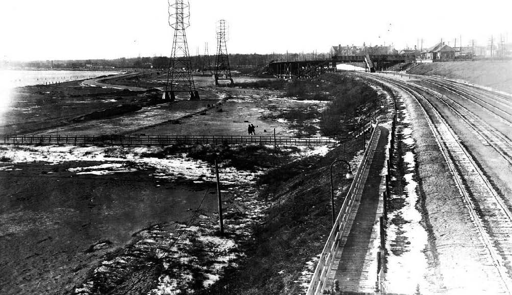
- By the 1800s, the city’s ravines and the Garrison Creek were overflowing with excess urban waste. The resulting pollution caused a public health emergency and, as a result, the creek was diverted into a below-grade sewer system and fully buried.
- The defensive importance of Fort York also declined and with the increasing prominence of rail transportation in the 1850s, Toronto’s shoreline around Fort York began to be filled in to make way for railways.
- In the 1850s, Niagara emerged as a prominent industrial centre. The factories and mills created a demand for workers housing which led ultimately to the residential development of the neighbourhood in the mid to late 1800s.
- Many of the immigrants to this area were Irish Catholic. Toronto’s first Catholic Church built to serve the western part of the city was in this neighbourhood: St. Mary’s Roman Catholic Church at Bathurst and Adelaide. Local school records also give evidence of early Irish, Jewish and other Eastern European influences.
The Abattoir & Wellington Destructor
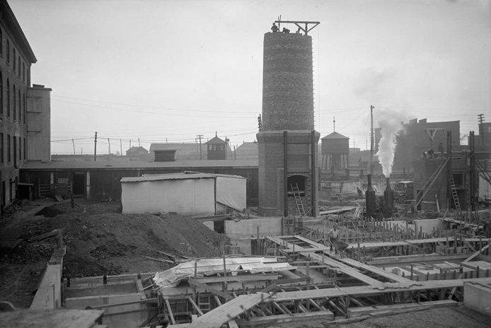
- In 1875, a cattle market was established on the 2 Tecumseth Street site and in 1914, a Municipal Abattoir was opened on-site in response to concerns about the monopolization of the meat packing industry.
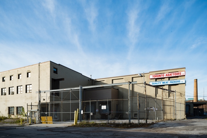
- In 1960, the Municipal Abattoir was sold to Quality Meat Packers. One of the country’s last abattoirs located in a major urban centre, the plant closed its doors in April 2014 due to the escalating pork prices. At the time of its closure, Quality Meat Packers accounted for approximately 25% of Ontario’s total pork production.
- This site also wraps around the iconic Wellington Destructor, a garbage incinerator built in the 1920s. Waste policies changed in the 1970s and the Destructor became a transfer station until it closed in the 1990s.
- Niagara Street row houses constructed between 1884 and 1890 were separated from the cattle market by Chamberlin Avenue, which by 1903 had been removed but is echoed by the configuration of the present laneway.
Niagara Today
- The Niagara neighbourhood is comprised of historic row houses and cozy one-storey cottages. In recent years, it has seen an explosion of new condominium and row house development.
- There are changes happening in the public realm as well – improvements like the revitalization of Stanley Park and the Garrison Crossing, and the introduction of the Bentway.
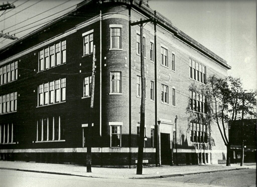
- Some of the important local landmarks include: Stanley Park, Niagara Street Junior Public School originally built in 1874, the Old York Tavern, Edulis (a Michelin star restaurant) and the Fu Sien Tong Buddhist Temple.
- The small Niagara Street Community Center, public pool and tennis courts at Stanley Park are important community assets.
- There is a strong sense of community, with community events throughout the year and lots of communication on various citizen-run blogs and Facebook Groups.
Great Laneway Names: Inspiration from Across Toronto
The Jewish Folk Choir Lane
The Jewish Folk Choir, which began in 1925, became on the most popular choirs in Toronto in the 1940s and 50s under conductor Emil Gartner. Emil and his wife Feygl Freeman, the accompanist for the choir, lived on Palmerston Avenue. Their home became a hub for choir activities which continued after Gartner passed away in 1960. Their daughter Esther eventually became the principal cellist for the Toronto Symphony Orchestra.
Louie Laki Lane
Louie Laki worked in a foundry and enjoyed a glass of homemade wine. He was kind, had a motorcycle and crushed his grapes in the backyard. He would cut your grass or fix your fence and invite you over to relax under the vines. He washed his wine casks in the lane. 133 of his neighbours got together and signed a letter asking the City to name an alley south of Harbord St. after him. At the unveiling in 2010, his daughter dug out a few bottles of her dad’s wine to share. It was still good.
Magic Lane
Magic Lane in Cabbagetown is named for Doug Henning, a Toronto-trained illusionist who was an 8-time Emmy award nominee and winner for NBC’s Doug Henning’s World of Magic program. Henning also had top-billing on several Broadway musicals, including The Magic Show and Merlin. In later life, the magician lived at 94 Winchester Street and became active in politics. He was the Senior Vice President of the Natural Law Party of Canada, a party based on the principles of transcendental meditation, and ran in the federal riding of Rosedale – now Toronto Centre – in 1993. He died in 2000.
Boys of Major Lane
The boys of Major Street – Chucky, Porky, Solly, Harold, Red and Joe – were honoured with four others in the name of a laneway off Harbord Street in 2013. The six teenage friends fought at the same time in the second world war, but only two came home. Joe Greenberg, known locally as Dr. Joe, was one of those who returned. The other was his cousin, Red. Major Street was home to a disproportionate number of young men killed in combat.
What other stories are important to this neighbourhood?
Desk research can only reveal a tiny slice of a neighbourhood’s history. Help us uncover the untold stories about the people, places and events that shaped this neighbourhood.
You can share your stories and ideas for what to name the laneway by filling out our survey.
City of Toronto Commemorative Naming Guiding Principles
Laneway names must meet the City of Toronto’s Guiding Principles for Commemoration:
1. Be informed by historical research, traditional knowledge and community insights.
2. Be supported by communities through meaningful engagement.
3. Honour Indigenous ways of knowing and being (note: This principle is specific to commemorations of significance to Indigenous Peoples).
4. Prioritize commemorations significant to Indigenous Peoples, Black communities and equity-deserving groups.
5. Connect to Toronto, Ontario or Canada’s histories and cultures.
6. Share knowledge and stories behind commemorations.
Process & Timeline
- TAS is helping to facilitate this naming initiative but ultimately, it’s a community decision (acceptable laneway names must be proved to have “general public support”)
- Early in the summer, we were gathering ideas from local neighbours and key community groups through this survey.
- TAS will compile the ideas from the survey and created a short list which we will share back with the community.
- The feedback we receive on the shortlist will be used to help make a final recommendation on a new name for the laneway.
- We will then submit the proposal to the City and it will go through a Technical Review and Guiding Principles Review, conducted by City staff. We’re aiming to send in the proposal in Fall 2023.
- Council will consider the staff’s assessment and public comments and make a decision on the proposed laneway name.
- Once approved, signage will be installed by the City.